To toggle the map between standard and satellite view, or to show real-time traffic flow or marker labels:
Open a screen containing the map, such as the Map screen.
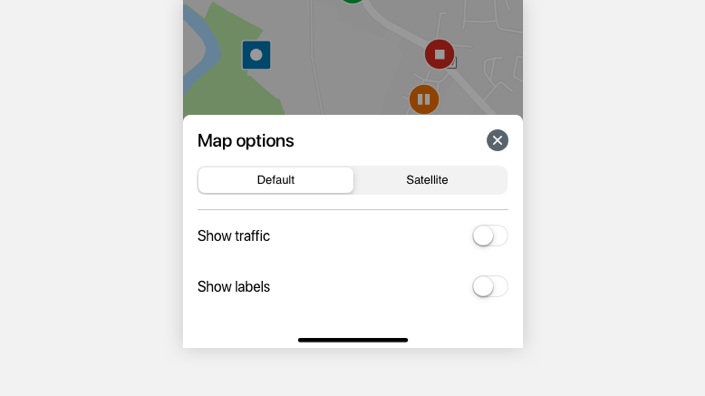
Tap the Layers toggle icon located on the map. The Map options panel opens at the bottom of the screen:
Tap either the Default or Satellite buttons to toggle between standard or satellite imagery on the map. Toggle the Show traffic button on or off to show real-time traffic density and flow on the map, and toggle Show labels on or off to show labels on map markers representing vehicles and assets. If you have a large fleet, the Show labels button might not be available.
Our agents can offer guidance on technical issues, help with installation, and answer account queries.
Wait time: 24 hours or less
Your Account ID:
Contact your Account Manager
Phone number: 0508 761 181 Option 4
Available Monday to Friday, 8 AM - 5 PM (EST).
Email:
Your Account Manager can help with any questions about your account or contract, and help ensure you have the right equipment and software services to get results.
 located on the map. The Map options panel opens at the bottom of the screen: